Photos for December 2015
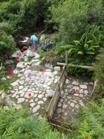
Notes: A - Tye channel; B - Work floor; C - 1st Settlement Pit; D - Central Gully; E - Walkway; F - Exit Culvert; G - 2nd Settlement Pit; H - Area of Entry Culvert / Pinch Buddle.
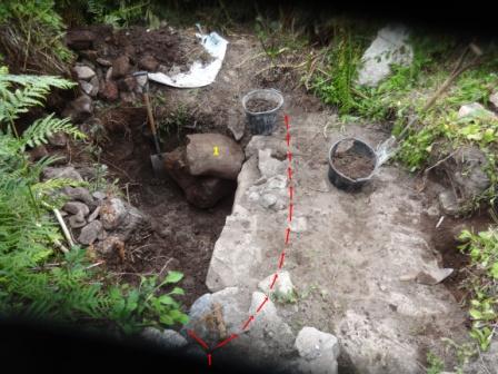
Red arrows show the exit culvert for the water. A sluice would have been erected at the point where the arrows split. This way the water could be run into the settlement pit to the left of out of the site completely to the right.
Yellow item 1: We believe this stone is a broken section of a clapper bridge stone. Certainly the bottom face, not visible on the photo, is very smooth through constant wear.